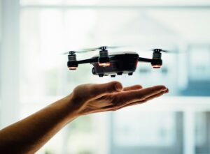
Drone Technology for As-Built Surveys
In the ever-evolving field of construction and land surveying, accuracy and efficiency have always remained key components. As-built surveys are critical for verifying that projects have been completed according to design plans. Traditionally, these surveys have been conducted using ground-based methods, but the addition of drone technology has introduced a transformative approach. Let’s dive into how drones are revolutionizing as-built surveys.
What Are As-Built Surveys?
As-built surveys capture the final dimensions and positions of structures and infrastructure after construction is complete. These surveys ensure that the built environment matches the approved plans and specifications. They are essential for many reasons, including quality assurance, compliance with regulatory standards, future renovations, and maintenance planning. Generally speaking, as-built surveys involve manual measurements and extensive fieldwork, often resulting in time-consuming and labor-intensive processes.
The Advantages of Drone Technology in As-Built Surveys:
- Speed and Efficiency: One of the most significant advantages of using drones for as-built surveys is the speed at which data can be collected. Traditional surveying methods can be and are usually very time-consuming, requiring surveyors to manually measure and document each element of a project. Drones, on the other hand, can fly over the site and capture comprehensive data in a fraction of the time. This rapid data collection translates to quicker project completion and faster verification processes.
- High-Resolution Data and Accuracy: Modern drones are equipped with advanced sensors and high-resolution cameras, enabling them to capture detailed and precise images and measurements. Drones can create highly accurate 3D models and maps, which are essential for as-built surveys. These models provide a clear and detailed representation of the built environment, ensuring that every aspect of construction is accurately documented. This level of precision is crucial for detecting any deviations from the original design and ensuring compliance with regulations.
- Cost-Effectiveness: While there is the initial investment into Drone technology, the long-term cost savings are substantial. Traditional as-built surveys often require considerable manpower, equipment, and time, all of which add to the overall expense. Drones reduce the need for extensive field crews and equipment, minimizing labor costs and reducing the overall expense of conducting these surveys. Additionally, the efficiency of drones allows for quicker project turnover, further reducing costs associated with prolonged project timelines.
- Enhanced Safety Construction sites can be hazardous environments, with risks such as falls, heavy machinery, and unstable structures. Using drones for as-built surveys significantly enhances safety by minimizing the need for surveyors to physically enter dangerous areas. Drones can safely fly over and capture data from these regions without putting human lives at risk. This not only improves safety but also ensures comprehensive data collection from all areas of the site that would otherwise be unreachable.
- Comprehensive Data Collection Drones provide a level of data collection that traditional methods cannot match. Equipped with various sensors, (some including RGB cameras, thermal sensors, and LiDAR (Light Detection and Ranging), drones can capture a wide range of data points. This data collection allows for a more detailed and accurate as-built survey. Drones can also access hard-to-reach areas, ensuring that no part of the construction is left undocumented.
- Real-Time Data Processing and Analysis Advancements in drone technology extend to data processing and analysis. Many drones now have real-time data processing capabilities, allowing surveyors to analyze data on-site and make immediate adjustments if necessary. This real-time feedback loop ensures that any gaps or inaccuracies in the data can be addressed promptly, reducing the need for repeat surveys and ensuring higher data quality.
- Versatility and Flexibility Drones can be easily reprogrammed and redeployed to different sites, making them ideal for multiple projects or changing survey requirements. This adaptability ensures that drones can be used for a wide range of applications, from residential construction to large-scale infrastructure projects. Their ability to operate in various weather conditions and terrains further enhances their utility.
Conclusion
The use of drone technology in as-built surveys represents a significant advancement through speed, efficiency, high-resolution data collection, cost-effectiveness, and more. As drone technology continues to evolve, we can expect even greater efficiencies and applications, further transforming the landscape of as-built surveying.
If you need an as-built survey, connect with us at Arc Surveys for a FREE quote, or give us a call (403-227-1272) / send us an email (info@arcsurveys.ca), we’re always happy to help!


